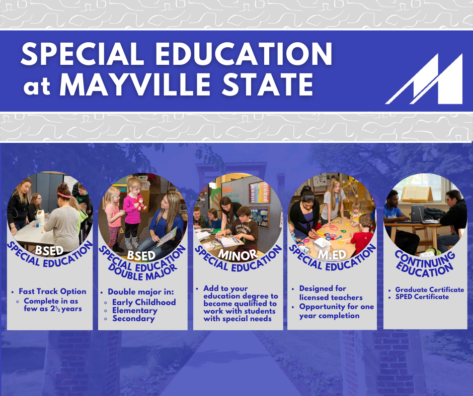
Mayville State University has been recognized as one of the most affordable and best colleges offering online degrees and higher learning in the nation by The Community for Accredited Online Schools, College Choice, and other sources. Mayville State University's online bachelor's degrees in Early Childhood Education, Mathematics Education, Mathematics, Business Administration, and Special Education have been recognized for high-quality and affordability by a number of organizations. Mayville State University offers 21 online and distance degree programs, 9 online certificates, and many online classes and other professional development opportunities.
MSU Online Office Information
Enrollment Center
Mayville State University
Campus Center Fish Bowl
330 Third Street NE
Mayville, ND 58257
Toll-Free: 1-800-437-4104
Phone: 701-788-4842
recruitment@mayvillestate.edu
Business Hours
September - May:
Monday-Friday, 8:00 a.m. - 4:30 p.m. (Central Time)
May - August:
Monday-Friday, 7:30 a.m. - 4:00 p.m. (Central Time)
Personal Attention: Distance class sizes are small, typically around 25 students per class section. You will receive personal attention from our experienced, helpful instructors.
Quality Instructors: The majority of our distance class instructors are full-time, on-campus instructors. This means you are receiving quality instruction from experienced university instructors.
Academic programs: Mayville State University is accredited by the Higher Learning Commission (HLC). Mayville State University is part of the North Dakota University System, and MSU is one of North Dakota's original colleges, since its establishment within the State Constitution in 1889. For more than a century, Mayville State has been training teachers and other professionals while maintaining the highest standards.
Affordable: Mayville State University has been recognized as one of the most affordable online colleges by CollegeAtlas (2020). Mayville State offers a high-quality education at an affordable distance/online tuition and fee rate.
Mayville State University's online tuition and fees for 2025-2026 is $347.38 per credit, regardless of residency, with a cap at 12 credits enrolled charged for tuition. Books, materials, and lab kits are additional. Please note, college tuition is subject to change without notice. Financial aid is available in the form of grants, loans, and limited scholarships.
Online Advisors: Online students are assigned a full-time academic advisor to aid in the successful completion of their degree plan.
Contact us to talk about how Mayville State Online courses and programs can help you grow professionally, personally, and academically.
Mayville State University has a full-time advisor on the Lake Region State College and online advisors to better serve students throughout North Dakota. Online advisors are available to support online students with academic and student support advising. Mayville State University takes pride in the attentive advising provided to students. Mayville State is a small campus and extends its history of personal service to our online and distance students. You are not just a number at Mayville State University!
At Mayville State, credits do not expire! Your credits will transfer from accredited institutions, even if you completed coursework 10, 15, or 25+ years ago!
Apply for Summer 2026 or Fall 2026 today! An updated class schedule and other information is available online, or contact an Enrollment Specialist with questions. Please Apply Now whether you are seeking a degree with us or just want to take a course or two as a non-degree student.
2025-2026 Viewbook

Resources & Key Links
- Contact Us
- Apply Now
- Admissions
- Financial Aid
- Online and Distance Programs
- Teacher Professional Development
- Distance Student Services
- ProctorU Instructions
- Academic Catalog and Calendar
- Transcript Request
- MSU Bookstore
- Accreditation
- Student Complaint Process
- Technology Requirements
- Instructional Technology Support at MSU
- Distance Student Handbook
- Adjunct Faculty Handbook
- Success Strategies for Online Success
- Collaborative Registration Form
- "How Do I" Guide
- Net Tutor Online Tutoring (free of charge)
- Non-degree Enrollment Instructions
Online Classes